

Roof & facade documentation
The high, steep, or storm-loosened surfaces a PE must read but cannot safely reach on foot, captured at close range.
unsafe-to-reach · roof · techoDocumentation that is evidence, not photography
Drone documentation here is not aerial photography. It is engineering evidence: the roof, facade, and structure a PE must read but cannot safely reach, tied to a licensed deliverable.
Capture. Read. Decide.
No-obligation project review. We reply within one business day, in writing.
How it works
What the flight supports
High roofs, steep slopes, and storm-loosened facades a PE needs to read without putting a person on a ladder in the danger zone.
Topografía con drones feeding the civil engineering: terrain, surface, and grade the drainage and site decisions are made on.
Post-storm and progressive damage captured so the property damage and hurricane inspection verdict rests on what is actually there.
Commercial-rule compliance and controlled-airspace authorization handled before launch, so the capture is lawful and the evidence holds.
The imagery exists to support a finding signed by the accountable engineer, which is what makes it evidence rather than media.
What we capture
A pretty aerial shot is not a finding. We capture what a licensed engineer needs to judge a roof, a wall, or a site.
The high, steep, or storm-loosened surfaces a PE must read but cannot safely reach on foot, captured at close range.
unsafe-to-reach · roof · techoTerrain, surface, and grade mapped to feed the civil and site engineering, where drainage and grading get decided.
topografía con drones · site mapPost-storm roof and facade condition captured for the structural verdict and for your own records.
post-storm · damage · dañosEvery frame tied to a licensed engineering finding inside the deliverable that carries a seal.
finding · hallazgo · sealedWhat a drone read surfaces
The conditions a drone capture brings into a licensed engineer's read, and why each one decides what happens next.
Membrane lifts, flashing failures, and cracked parapets on a roof no one has stood on since the last storm. Why it matters: the leak you are chasing inside usually starts at a defect you cannot see from the ground.
Spalling, loose render, and corrosion staining on an upper wall too high or too unstable to reach. Why it matters: a facade dropping material is a life-safety question, and the engineer needs to see it before someone is under it.
Grade, slope, and standing-water patterns mapped across a parcel that walking it never reveals. Why it matters: drainage and retaining decisions are only as good as the terrain model the civil read is built on.
Need the evidence, not the photos
If a contractor or a carrier asked for "drone shots," what they actually need is a licensed read. We capture what an engineer needs to judge a roof, a wall, or a site, and we put it inside the deliverable that carries a seal. The imagery is the input. The engineering finding is the product.
Tell us what you need documented and why. We will tell you whether a flight is the right tool.
Who stands behind it
The flight is a tool. The deliverable is an engineering opinion from one accountable Puerto Rico engineer who stamps within his scope, so the documentation holds up where it counts. That is also why the accountable engineer behind every finding is named, not anonymous.
The accountable engineer
Every finding the drone supports is one I will put my seal to. That is the difference between evidence and a photo gallery.
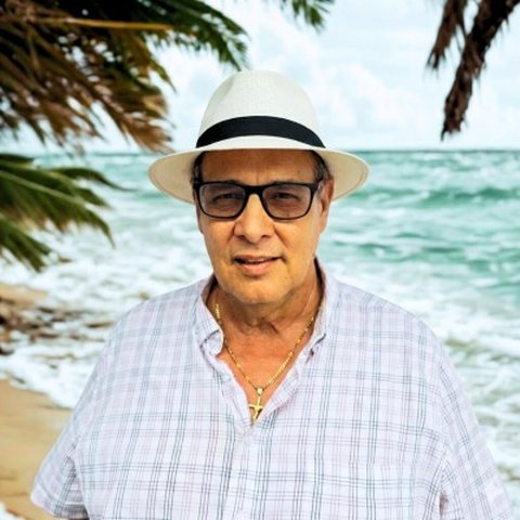 Edgardo L. Santiago Martínez, PE Chief Engineering Officer · PE Lic. #12474, CIAPR
 FAQ
Still deciding? Ask us directly, no obligation, and you hear back within one business day.
No. It is engineering evidence. The imagery exists to feed a licensed finding: a roof condition, a facade defect, a site map. Every flight is tied to an engineering deliverable, not a gallery.
When the roof, facade, or structure is unsafe or impractical to reach directly, or when a project needs survey-grade site mapping. The drone is a tool inside the engineering read, not the product.
That is our responsibility, not yours. We fly under the FAA Part 107 commercial rules and clear the airspace before launch, including any controlled-airspace authorization near airports. You do not arrange anything; we scope the flight and the clearance on the first call.
A boundary survey (mensura) by a licensed surveyor establishes legal property lines and is its own scope. Drone survey-grade mapping captures the terrain, surface, and condition a project needs to engineer drainage, grading, and site work. The two are complementary, not interchangeable, and we tell you which one your decision needs.
Yes. Survey-grade aerial mapping (topografia con drones) feeds the civil and site engineering, where the terrain and drainage decisions get made. The map exists to inform the engineering, not to sit in a folder.
Yes. Where a roof or facade is unsafe to access after a storm, drone capture documents the condition for the structural verdict and for your records. The imagery feeds the engineering read; the read is the deliverable.
Yes, island-wide, weather and airspace permitting. We scope the flight on the first call, confirm the access and any clearance, and tell you straight whether the conditions allow it.
Where this fits
Drone documentation is a supporting method. It earns its keep by feeding a licensed engineering deliverable.
Drone evidence for the post-storm structural verdict, where the roof or facade is unsafe to reach.
Survey-grade mapping (topografía con drones) feeding the drainage, grading, and site decisions.
Documentation of conditions a PE needs to judge but cannot safely access, inside the structural read.
Planning a purchase or a site? See the guide to cadastre, survey and title in Puerto Rico.
The flight is the input. The signed finding is the product.
Turn access into evidence
The structure, the access, and what the decision needs. We reply within one business day, in writing, with next steps.
Direct channels
One-business-day response standard. Reach us by any channel and you hear back within one business day, every time.
Not sure a flight is the right tool?
Tell us the question first. If the answer is a ladder, a survey, or a structural read instead, we will say so. The fastest path is a short, no-obligation call.